
Thunderstorms and very heavy rain moved across southern Missouri and Northern Arkansas, Friday afternoon and evening and caused severe flooding throughout the region. In Thomasville, the town had to be evacuated because of flooding. Authorities are still assessing the damage.
The City of West Plains was devastated by flooding with businesses north of town being flooded. The Howell County Emergency Management says there have been roughly five or six water rescues in West Plains. The emergency manager also said a woman was hit by lightning in Moody, Mo., and was taken to the hospital.
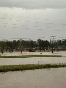

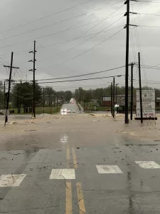
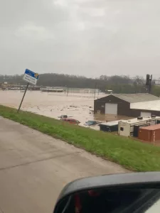

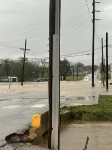
Parts of Hardy were evacuated because of flooding along the Spring River. Authorities say they expect the flood stage to crest at 23 feet on Saturday. Several agencies were stationed in town, including the National Guard. The American Red Cross set up a shelter at the Old Hardy Gym.
In Baxter County, Authorities reported several road closures. In Norfork, County Road 63 was closed.
In Flippin several residents were evacuated on Sunset Street.
Road closures were also reported in Fulton County at the Sturkie Bridge. Ozark County reported several road closures.
In Mammoth Spring roads were closed north of town around Old Town.
Arkansas Highway 9 northeast of Union in Fulton County and Arkansas Highway 395 north from Salem to the state line were closed
In Izard County, Sheriff Melton reported that there were people trapped by flooding waters, and while he was trying to get to them, and drove into a washed out part of the road. The sheriff was uninjured in the accident.
MODOT reports several road closures in the listening area. As of 10:30 pm April 4, 2025
Carter County:
- Route M- 6 miles off Route 60 to the end of Route M
- Route 103 – at Big Springs Park
- Route Z – entire route
Douglas County:
- Route U – 4 miles north of MO 76 at Bryant Creek
- Route FF – 2 miles east of MO 14 at Hunter Creek
- Route Y – 3 miles west of Route 5 at Cowskin Creek
Howell County:
- Route K- County Road 6720 to County Road 7290
- Route 142- Route FF to Route E
- Route EE- Route 17 to County Road 3730 (Storm Debris)
- Route 17- Route W to Route W (To the south of Mountain View)
- Route Y- at Turnerville
- Route 17 – at CR 8390
- Business 63 in West Plains – entire route
Oregon County:
- Route 160 – Alton to Homas Hill
- Route M – Route 160 to Route 63
- Route 99 – 1 mile north of Thomasville to Route 160
- Roue 19 – At Frederick Creet and Warm Fork Creek
- Route 142 – 5 miles east of Thayer
- Route 142 – at Eleven Point River
- Route A – one-quarter mile west of Route E at Frederick Creek
Ripley County:
- Route 21 – south of Route K
Shannon County:
- Route NN- Route H to County Road 522
- Route H- County Road 507 to County Road 514
- Route T – Seven miles south of 60 to Route MM
- Route YY – County Road 341 to County Road 345
- Route N – entire route
Wright County:
- Route AB- Dennis Road to Hunt Road
Travelers are advised to use extreme caution when traveling the area roadways and never drive into water over the roadway. Remember: turn around, don’t drown.
For a Complete Look at All the Latest News Click Link Below
https://www.ecommnewsnetwork.com/category/news-daypop/


